Presentation
Central City Axis consists out of most representative urban public places and buildings in Zagreb with important urban functions. The visual perspective along the Central Axis is an important element for Zagreb identity. The axial organization enables the long view at the Zagreb cathedral with the Medvednica mountain in the background, all the way from the Sava River and the central Bridge of Liberty – Most Slobode.
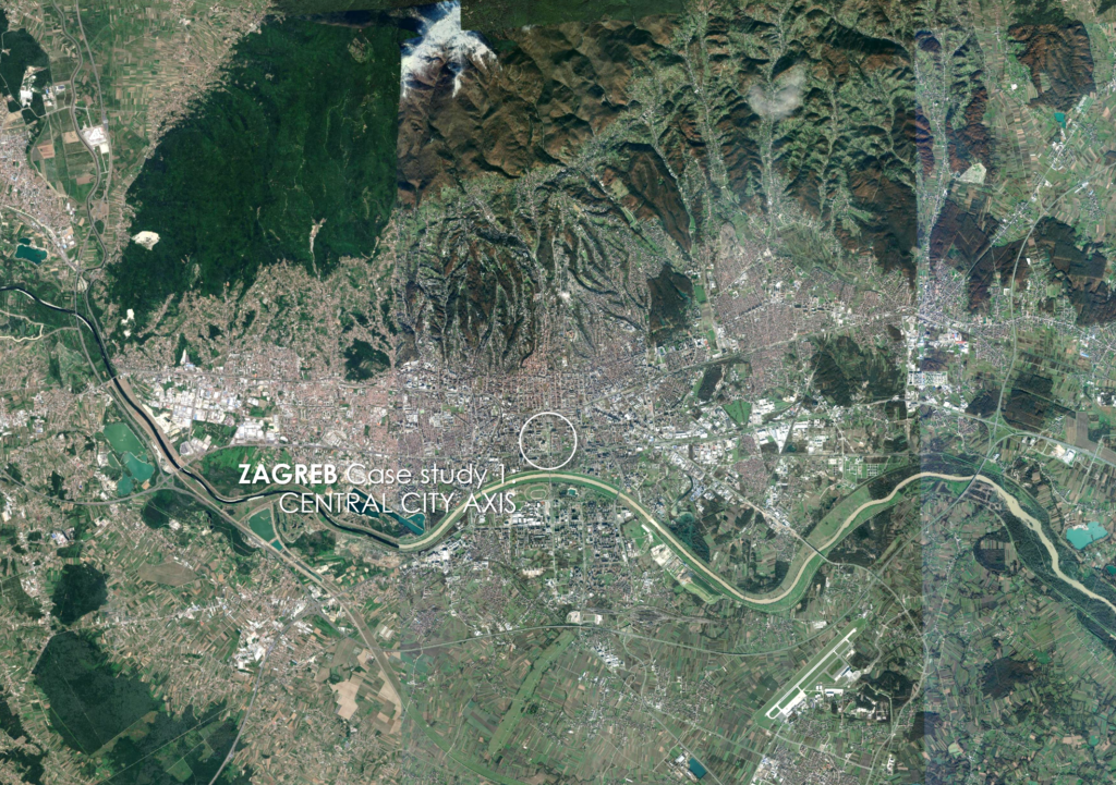
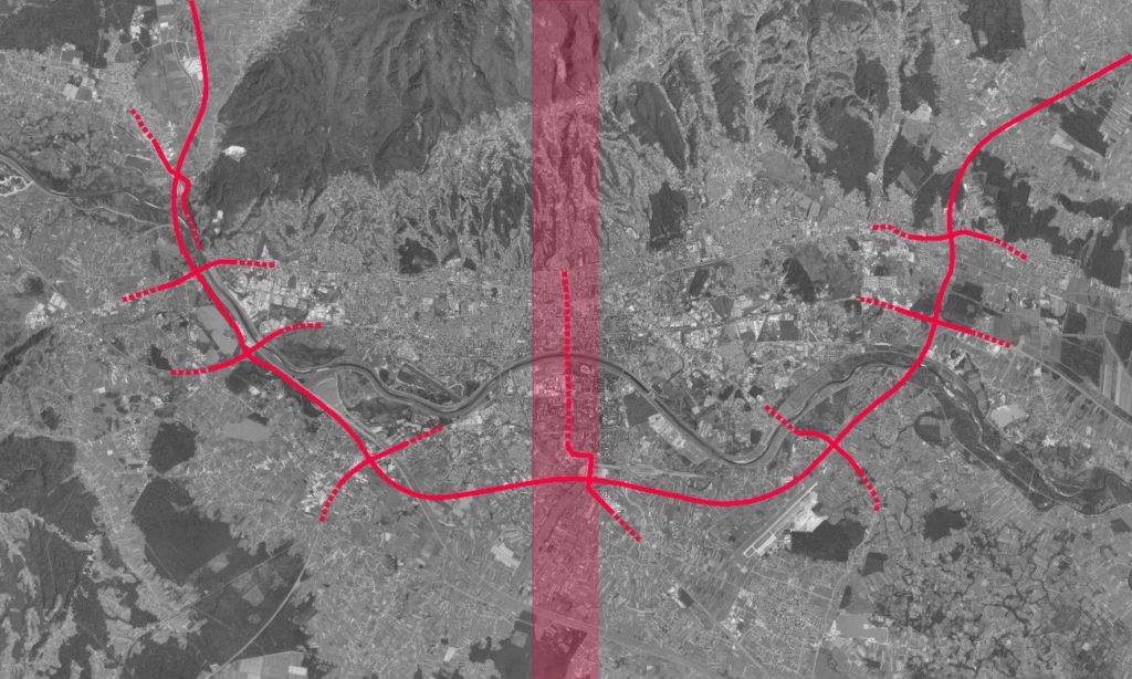
The Axis begins at the eastern part of Zagreb Green Horseshoe, located at the historic central area, which is the urban core area distanced 2,5 km north from the Sava River. The railway is a border between this urban core in the north and inner urban area of the city stretching from the railway to the Sava river which is the beginning of the Zagreb peri-urban zones. The railway is the first divider in the urban fabric of a city and the Sava river is the second large discontinuity in the peri-urban continuum. The embankments and floodplain system additionally separate the city red areas from the river landscape or the blue layer.
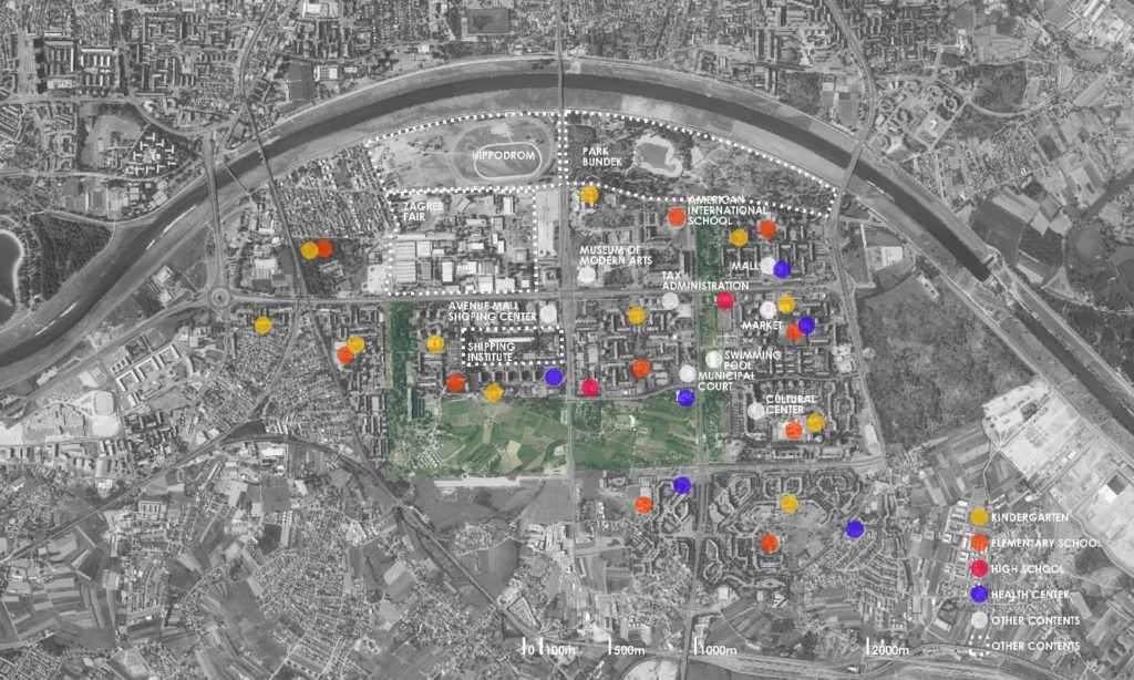
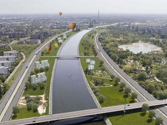
South of the Sava River, the axis stretches through Novi Zagreb neighborhoods of late modernist concept built in the second part of the 20th century. In Novi Zagreb, the Central Axis is formed as an avenue-corridor with surrounding urban contents (Bundek public park, Bundek residential district, Museum of Modern Art, Hippodrome, Zagreb Fair, shopping mall). Further towards the southeast, on the periphery of New Zagreb, the axis loses its clear avenue linear north-south geometry when connecting to the motorway. It extends as an infrastructure corridor (emphasis on private and public transportation) which connects Zagreb city centre with satellite town of Velika Gorica and the Zagreb Airport.
Greening issues and/or actions for the transition to sustainability in the peri-urban context of Central City Axis are recognized in vegetation succession in abandoned sites, and in the system of public urban spaces where green and landscape is used as a passive element, as a background.
Traffic and communal infrastructure are finished along the whole length of the Central City Axis.
Although Central City Axis is a planned urban axis, there has never been a master plan made and adopted solely for the development of the axis. Propositions and guidelines for its development have been, and still are, part of city level Master Plan. Even though the axis was planned in the context of a wider plan, it was developed in segments, fragmentary. Segments of Central City Axis and public places waiting for urban transformation are objects of different propositions, projects, and studies, which do not envision or integrate individual areas with the whole of the central axis.
Geographical area
Zagreb is situated on the south slopes of Medvednica mountain and along the lowlands of the Sava river. The landscape of Medvednica is integrated into the city by landscape and forest ‘green fingers’ along the slopes, which connect the mountain natural landscape to the city center.
Spatial planning scale challenge for Central City Axis covers:
- a disconnection between plans of different and same level despite strict hierarchy of spatial planning
- fragmentation of spatial and urban planning practices
- different stakeholders are just formally included in the process of defining program and proposals for sites of public importance and the future development of cities
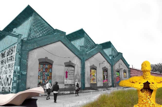
In the City of Zagreb development strategy for the period up to 2020, Central Axis is set as one of the key directions called AXE – Cultural functions with the three areas of strategic development projects all dealing with the red infrastructure: Gredelj, Congress centre, and Zagreb Fair area.
City scale challenge for Central City Axis covers:
- the whole approach to planning Central City Axis as only done on a strategic level, through Development strategy of the City of Zagreb as an AXE – Cultural functions
- on the implementation level, Central City Axis is developed fragmentary through city projects (Public park Croatia in Small)
- program for Blue Horseshoe is not defined on any level of Zagreb urban planning
- urban-architectural competitions (often closed for public participation) are the main method for gathering proposals when dealing with the sites of importance for the future urban development of Zagreb
Central City Axis is strategically developed as a representative entrance to the city. Development of the city axis is based on the city grey layer (traffic and communal infrastructure), planned with the redevelopment of former industrial sites and a system of public places. In the planned system of public places, the landscape is considered as a background, and not as a landscape network which can contribute to urban sustainability.
Axis scale challenge for Central City Axis covers:
- redevelopment of former industrial sites and development of public infrastructure are major investments for the city and therefore in danger of not being completed
- in the planned system of public places of Central City Axis and Blue Horseshoe, the landscape is considered as a background and not as a landscape network which can contribute to urban sustainability
Inhabitants, general public and planners were not included in the whole process of Central City Axis planning and development. The public space of Central City Axis is the object of conflict between different stakeholders and different interests.
District scale challenge for Central City Axis covers:
- how to preserve unbuilt places planned as a system of public parks, from unregulated development
- local inhabitants, the general public and planners are not included in the whole process of planning and development of Blue Horseshoe
Central City Axis is formed as a southern extension in line with the eastern part of Zagreb Green Horseshoe. Zagreb Green Horseshoe is a sequence of park squares in the urban block matrix of historic Downtown of Zagreb, planned and built in the second part of the 19th century. The Zagreb Central Axis is planned a concept extending across the railway toward the south and the Sava River with a sequence of public spaces along and between main avenues. South of the Sava River, the axis stretches through the New Zagreb area. Central City Axis and its extension towards the southeast, is a traditional connection between the city center, south city suburbs, the biggest satellite town of Zagreb Urban Region – Velika Gorica – and Zagreb Airport.
Zagreb has two Horseshoes as sequences of landscaped public places – Green Horseshoe of Down Town and Blue Horseshoe of New Zagreb. Zagreb City Axis connects the two Horseshoes, Green Horseshoe north of river Sava and Blue Horseshoe south of river Sava.